HOME INSPECTION & FOUNDATION REPAIR
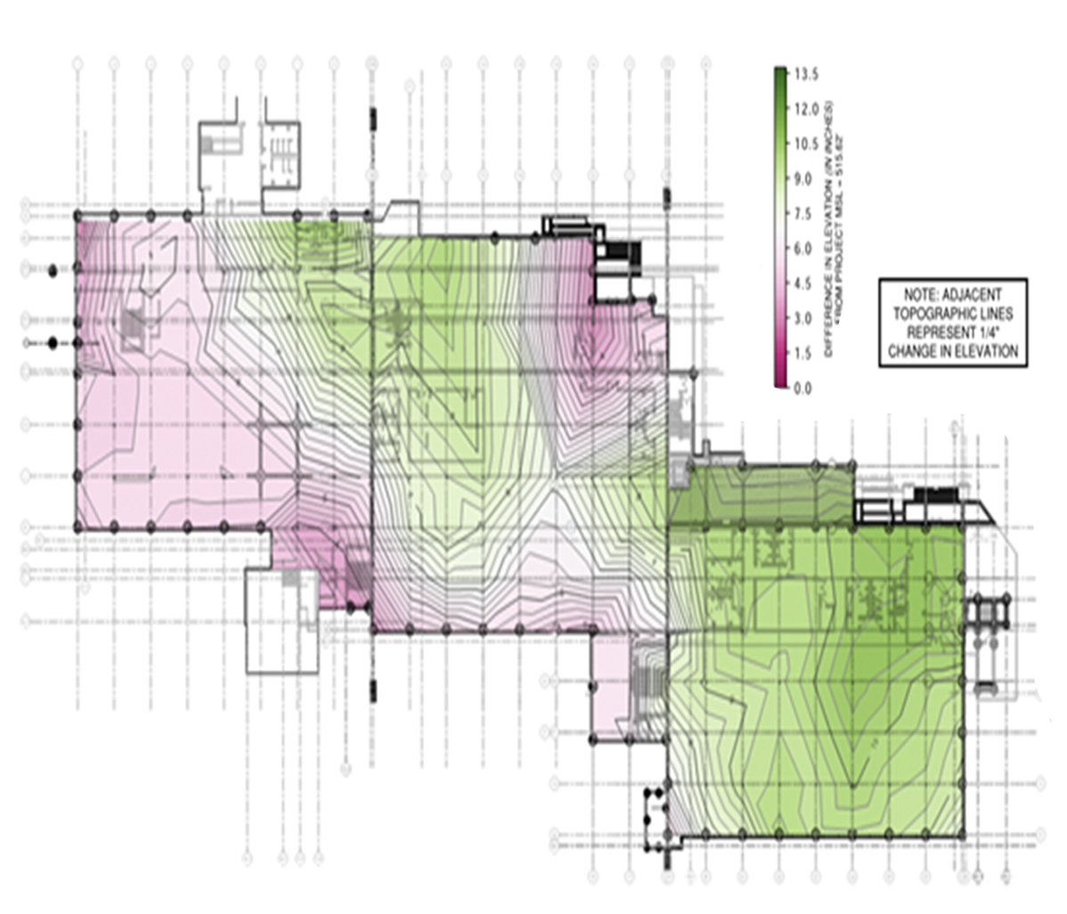
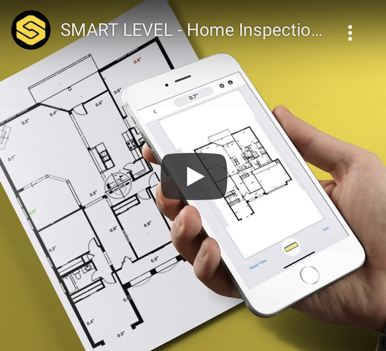
Smart Level uses Image Mapping to add readings directly into your photo or PDF so your measurements are more accurate in a fraction of the time.


1
$995.00
Features
Smart Level App Connects by Bluetooth
- View elevation readings in real time or store data for use later.
- Custom Name elevation points. (e.g. – Back Porch Step = 0, South Back Corner = -18.5” etc.)
- Allow the user to plot height, direction and angular measurements, along with notes.
- Generate graphs and charts on your laptop or smart device in real time.
Flexible Increments
- For establishing grades and distances.
Export Data
- Export Data into Excel.
- Export Data as “PNG” image format.
Auto Zero
- Set any point as your “0’ reference point.
Quality Central Processor"
- Captures data points quickly and precisely.
- Backlit display for easy reading in dark or dim lighting.
Imperial or Metric
- Capture data in Imperial or Metric.
- Set your own desired increments.
- Set a custom margin of error for quick calculations.